
Oakland County ZIP Code Coverage
Oakland County covers 907 square miles and contains 62 cities, villages, and townships. Its postal geography does not follow those government borders. The county’s working list includes ordinary delivery ZIPs, codes used for post-office boxes or auxiliary postal service, and codes shared by more than one local government. Treat the entries below as postal coverage examples. For a specific address, use the final delivery check rather than assuming a community name or map label settles the postal code.
| Postal code | Common Oakland coverage | Postal identity | Local caution |
|---|---|---|---|
| 48025 | Beverly Hills, Bingham Farms, Franklin | Shared delivery area | One ZIP crosses several local governments. |
| 48076 | Lathrup Village and Southfield | South Oakland delivery area | A postal line is not the city line. |
| 48167 | Northville, Novi Township, and the Oakland County part of Northville | Cross-boundary area | County, city, and township splits matter. |
| 48306 | Rochester and Oakland Township | North Oakland delivery area | Southern Oakland Township and northern Rochester Hills context can overlap. |
| 48341 | Pontiac and county-campus area | Pontiac delivery area | Postal service does not make every record a county record. |
| 48359 | Lake Orion and Orion Township | Village and township delivery area | Confirm the municipal custodian for local records. |
| 48442 | Holly, Brandon, and Holly Township area | County-edge postal area | Verify the exact address because postal coverage crosses local boundaries. |
Some codes are especially easy to misread. Troy has 48007 and 48099 for post-office use, Birmingham has 48012, Southfield has 48037 and 48086, and Rochester Hills has 48308. The research identifies these as PO-box or auxiliary-style postal usage that needs a delivery-point check. Likewise, 48397 and 48398 have Oakland-area auxiliary use but no exact local delivery area found in the official crawl. The ZIP code directory should narrow an address, not replace USPS confirmation.
South Oakland Postal Bands
South Oakland has dense postal overlap. Birmingham appears with 48009 and nearby 48012, while Royal Oak uses 48067 and 48073 alongside 48068 postal use. Southfield has 48033, 48034, and 48075, and its postal relationship with Lathrup Village appears in 48076. Troy uses 48083 through 48085 and 48098, with separate PO-style codes in the same overall area. These ZIP patterns are helpful for sorting an address, but the responsible record office still follows the parcel’s city, village, or township.
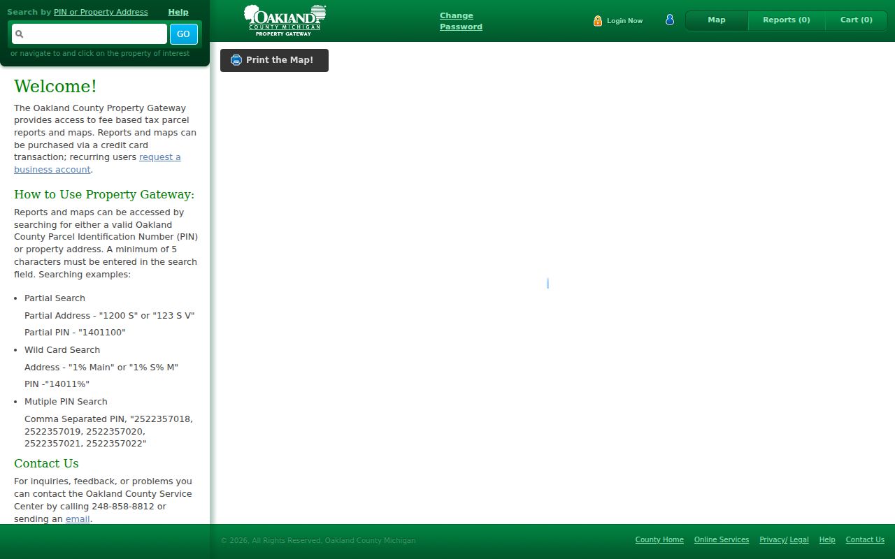
A property record cannot be safely inferred from a ZIP alone. Oakland County Property Gateway searches by property address or PIN, not a ZIP filter. It accepts at least five address characters, partial strings, a percent-sign wildcard, partial PINs, comma-separated PINs, and map clicks. The Gateway identifies a parcel’s municipality from the parcel, which is the useful next step after a postal area has narrowed the search.
The Property Gateway interface is shown here. It is parcel and address focused, so it can connect a verified delivery address to an Oakland parcel without suggesting that a postal label itself identifies a resident.
Reports, maps, photos, sketches, history products, and tax-related material can vary by municipality, and some products require payment. The county warns that municipal source data may be classified or updated differently. A map position is useful for context, but it is not a legal survey and a tax mailing address is not proof of present occupancy.
Pontiac Postal Geography
Pontiac’s 48340, 48341, 48342, and 48343 cluster illustrates why a postal label and a records location are different things. The county seat and county offices are associated with the 48341 area, but Oakland’s county campus is a service hub, not a substitute for the city or township that maintains a local permit, code, cemetery, or assessment record. A Pontiac parcel, Troy voter record, Novi permit, and Royal Oak directory entry can all require different custodians even though they fall within Oakland County.
The same boundary issue appears elsewhere. 48323 serves Orchard Lake and West Bloomfield, 48326 reaches Auburn Hills and Lake Angelus, 48347 crosses Clarkston and Independence Township, 48387 covers Union Lake and the Commerce and Waterford edges, and 48390 serves Walled Lake and Commerce Township. ZIP codes classify postal delivery. They do not establish parcel title, local court jurisdiction, voting precinct, school district, or municipal authority.
Note: Keep the postal city and ZIP beside the parcel PIN, situs, and legal description so later searches do not confuse delivery geography with record jurisdiction.
Find Residents by Oakland ZIP Code
A ZIP can narrow where to begin, but Oakland’s official systems do not all search it the same way. First verify the delivery point, then use the county map to understand the area, and finally switch to the system keyed to the record you need. Property work uses an address or PIN. Voter-file requests use county, jurisdiction, district, village, or ward and precinct choices. Public-safety registry searches use ZIP and radius modes under their own statutory limits. A postal-area search should never be presented as a complete household list.
- Confirm the full delivery address with USPS. Record the ZIP that the postal service assigns to that address, including any ZIP+4 when needed for mail.
- Open the county GIS ZIP Code Area layer and compare the delivery geography with municipal, precinct, school, and tax-district layers. This supplies context, not a legal boundary.
- Search Property Gateway by the verified address or PIN. Save the parcel’s municipality, situs, and PIN before looking for a deed, tax record, or local file.
- For voter material, request only the lawful QVF geographic scope through the local clerk or Michigan Bureau of Elections FOIA route. A QVF request does not select people by ZIP.
- When the task narrows to one street or parcel, use the Oakland Street Directory for the address-keyed record chain instead of repeating a ZIP-wide search.
Michigan.gov/Vote is for a voter’s own individualized information, registration status, clerk, polling, and ballot details. It is not a public browse-by-ZIP system. A public voter-file extract is governed by MCL 168.509gg, which excludes protected fields and Address Confidentiality Program records. The county or local clerk can help identify the correct jurisdiction or precinct request, but a response must retain the statute’s redactions.
Oakland ZIP Portal Inputs
ZIP-enabled routes have very different purposes. The Michigan Public Sex Offender Registry accepts a city, county, ZIP, street, and radius for its statutory public-safety search. It is not a general Oakland resident lookup and it does not provide a complete download. Property Gateway, the QVF route, and county GIS each use a different input pattern. Knowing the distinction prevents a ZIP code directory search from being stretched into a claim the underlying portal cannot make.
| Official route | Input or geographic key | ZIP role and limit |
|---|---|---|
| Michigan PSOR | Name, registration or MDOC number, or street with city, county, ZIP, and radius | ZIP and radius are available within the statutory registry; use only for that public-safety purpose. |
| Property Gateway | Property address, PIN, map click, partial or wildcard address | No ZIP field; move from verified ZIP to an address or parcel. |
| Enterprise GIS | Map and administrative layers | The ZIP Area layer adds map context, not a person list or certified boundary. |
| Michigan QVF request | County, jurisdiction, district, village, or ward and precinct choices | No ZIP selector; public fields remain subject to redaction. |
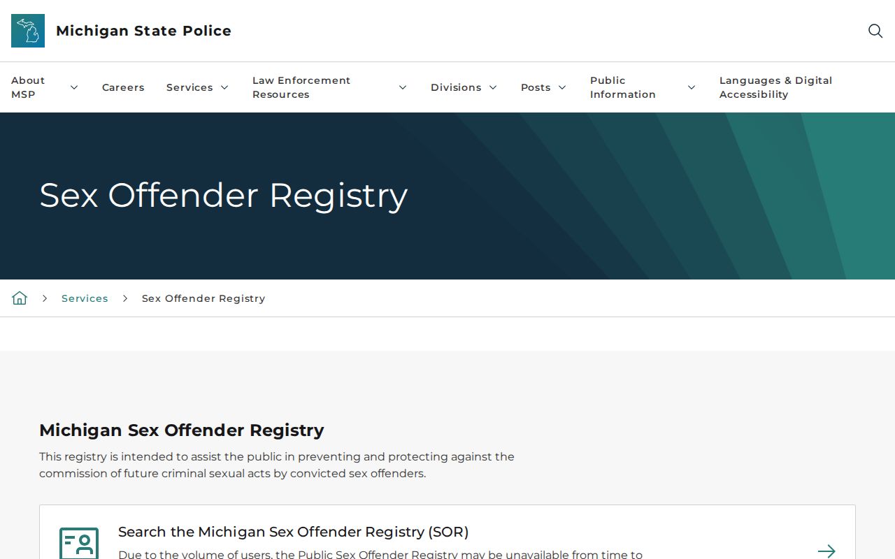
The PSOR search screen illustrates the ZIP-and-radius route. Its public information has defined limits, including no complete download and withheld victim information. An absent result can have statutory explanations and should not be turned into a broad resident conclusion.
For ordinary parcel, election, or local-record questions, return to the accountable custodian. The state and county systems answer separate questions, and the local community often keeps the underlying building, code, cemetery, or assessment file.
Oakland County ZIP Map Context
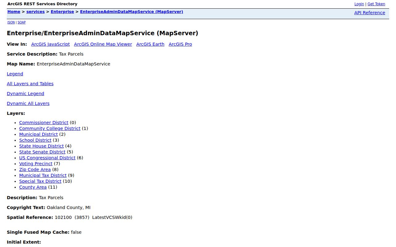
Oakland’s Enterprise GIS service places the ZIP Code Area layer beside parcel, Voting Precinct, Municipal District, School District, State House, State Senate, Congressional District, municipal tax district, special tax district, and County Area layers. This is the geography interest that makes a ZIP useful without overclaiming it. A ZIP can overlap one or more of those layers without sharing the same boundary. Use the layers to identify questions for the right custodian, not to decide a legal line from a map label.
The Enterprise GIS MapServer is shown here. It is a spatial map service, not a certified record. Follow a parcel’s address or PIN into Property Gateway, then use the clerk, assessor, election office, or local community named by the record type.
ZIP uncertainty is most common near the county edge and across mixed city-township areas. The research flags New Hudson and Lyon Township, Northville and Novi Township, South Lyon and Lyon Township, Fenton, Holly, Ortonville, and township edges as places where a postal identity can differ from the municipality or county context. Preserve both the postal and local-government labels in a search log.
Check an Oakland ZIP Delivery
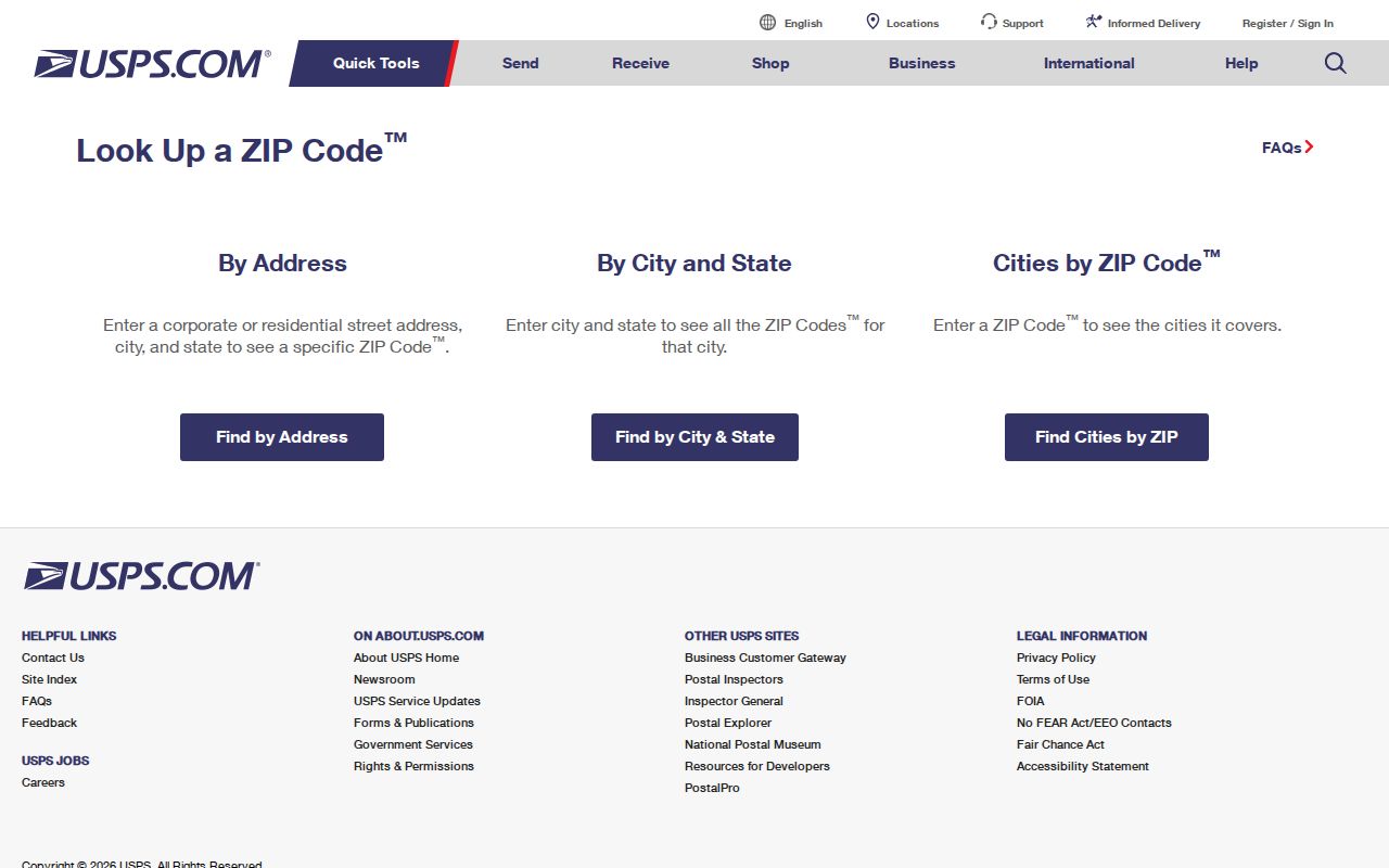
The final ZIP code check belongs with the USPS ZIP Code Lookup. Enter the full delivery-point address rather than relying on a community list, a county GIS layer, or an old directory. This is especially important for PO-box-style codes, auxiliary codes, rural areas, and city-township edges. USPS resolves postal delivery. It does not establish the address’s owner, resident, precinct, or record custodian.
The USPS lookup screen is the delivery check for a specific Oakland address. Keep its result with the street address and verification date before passing the address to a parcel or local-government search.
A ZIP+4 narrows mail sorting beyond the five-digit ZIP. A PO-box ZIP serves post-office boxes rather than a general street-delivery area. A unique ZIP is used for a single institution or large recipient, though no Oakland example should be assumed without a USPS result. A carrier route is a mail-delivery grouping, not a municipal district or resident roster.
Oakland ZIP Boundaries and City Limits
Postal-code boundaries are postal constructs, not county, city, school, precinct, or parcel boundaries. Oakland GIS describes them as map layers, while USPS verifies delivery. A local government boundary is the more stable jurisdiction for records. Preserve the situs, postal city and ZIP, parcel PIN, and legal description together. That four-part record prevents a ZIP code directory result from being confused with municipal jurisdiction or parcel identity.
- ZIP and ZIP+4
- The five-digit ZIP identifies a broad postal area. ZIP+4 adds a delivery-sorting segment for a more specific mail destination.
- PO-box ZIP
- A PO-box ZIP is assigned for postal-box service and may not describe a general street-delivery area.
- Unique ZIP
- A unique ZIP can serve one institution or large recipient; verify it through USPS rather than assuming one from a map.
- Carrier route
- A carrier route groups mail delivery stops. It is not a city limit, precinct, or list of occupants.
For a correction or a disputed public record, contact the underlying custodian rather than USPS or a map layer. The assessor handles parcel data, the clerk maintains the relevant court or vital index, and the local election clerk handles registration records. Postal geography helps place a record. It never grants access to private household information or overrides Michigan confidentiality rules.