
Oakland Street Directory Trail
A useful street-by-address search begins with the physical parcel, not a name. The county’s address tools can connect a street number to a parcel identification number, known as a PIN, and identify the municipality that supplied the assessment data. From there, the land index can tie the parcel to recorded instruments. Those sources describe land and recorded parties, rather than confirming everyone present at an address. A voter-file request and dated directory entry have different limits, so they should be treated as separate evidence. Keep the address spelling, PIN, municipality, map date, source URL, and the role shown for each name.
- Enter the street number and name in Property Gateway, select the matching parcel, and record its PIN and municipality.
- Open the parcel on the county map and examine nearby lots only as geographic context, not as proof of a household.
- Use the PIN, legal description, or party names in the Super Index to locate the latest recorded land instrument.
- For registered-voter evidence, request a legally releasable QVF scope from the local clerk or Michigan Bureau of Elections rather than trying to browse Michigan.gov/Vote by street.
- When the question is historical, check a reverse directory for the appropriate community and year, then compare its address with the parcel trail.
This sequence separates an owner, a tax-mail recipient, a dated directory listing, and a voter-record entry instead of treating them as one claim. For one named person rather than a whole street, the Oakland resident lookup uses a different verification path.
Oakland Street Numbers to PINs
Property Gateway is a map-first county tool. It accepts a property address or a ten-digit PIN, requires at least five characters for an address query, and allows partial address text, partial PINs, percent-sign wildcards, and comma-separated PINs. The municipality is identified from the parcel. That matters in Oakland County because local communities contribute assessment information, and their update or classification practices can differ. A result is a strong way to anchor an address lookup, but the county warns that the map is not a legal survey and that report availability varies by municipality.
The official Property Gateway address and PIN search is shown here.
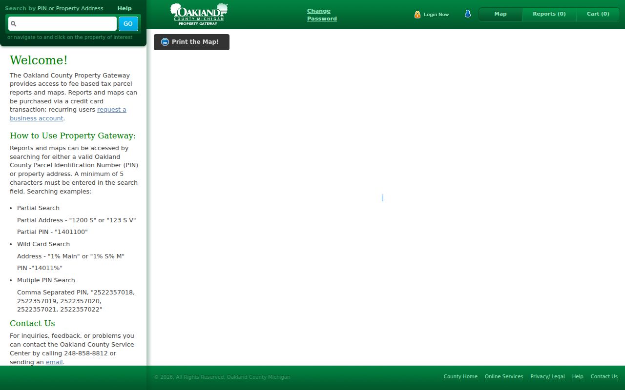
The search screen reflects the parcel-first method: start with the physical location, select the result, and preserve the PIN before moving to another source. A report or map product can have a charge, while basic search and map access provide the initial street-level route.
Note: A PIN connects land records; it does not by itself establish current presence at the Oakland address.
Oakland Address Search Fields
Search syntax changes between county systems. Gateway takes a property address or PIN and can be navigated by map click. The separate tax application uses parcel ID plus city, village, or township and code, or a number-and-street address with municipality and tax type. Do not carry the Gateway format into the tax form without checking its rules. The field list below captures the documented Gateway controls, including the checkout-only fields that appear when a report or print product is selected.
| Gateway field | Form | When needed | Oakland use |
|---|---|---|---|
| Property Address | Text | When no PIN is used | At least five characters; partial and wildcard text accepted. |
| PIN | Text | When no address is used | Ten digits; dashes optional; partial, wildcard, and multiple values accepted. |
| Map click | Map control | Optional | Navigate to and select a parcel of interest. |
| Product or report | Selection and cart | Optional | Availability varies by municipality; preview, cart, and checkout follow. |
| Email and print choices | Text and dropdown | Checkout or print map | Used for delivery and selected map output. |
The address result is more reliable when the street spelling, house number, and PIN are stored together. A missing report window can also be a browser issue: county guidance says pop-up blockers can prevent a post-checkout report window from opening. If a municipal product is absent, use the parcel map as the start, then contact the municipality that maintains the local assessment or permit record.
Oakland Streets Through GIS Layers
The county Enterprise GIS service gives an Oakland street search its geographic context. Its public layers include parcels, Voting Precinct, Municipal District, School District, ZIP Code Area, tax districts, County Area, and state and federal districts. Zoom along a street, select a parcel, then use the linked PIN or address to open the property trail. A ZIP layer, precinct line, and city boundary may overlap without matching. That is why the physical parcel and responsible municipality belong in the notes for each address.
The official Enterprise GIS layer service displays the administrative layers available for Oakland streets.
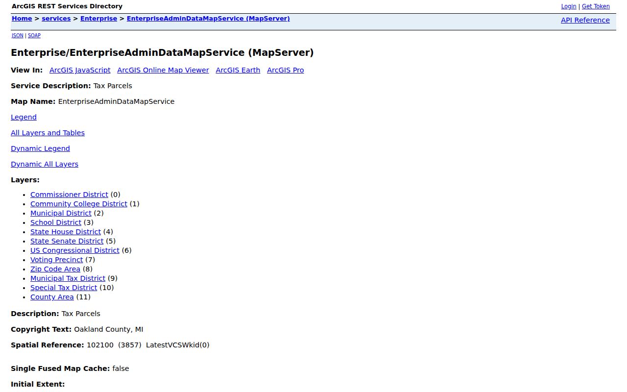
The service is a map and query resource, not a certified record. It has a maximum record count of 2,000 and supports technical query formats, but an interactive parcel-by-parcel review remains the sounder street method for a reader tracing a manageable run of addresses.
Oakland Street Ownership Chain
Use the Oakland County Super Index after the parcel is identified. Free indexed searches can use party, PIN, document, date, and advanced criteria. Online recorded-document access begins January 1, 1964, while older land books, tract indexes, and microfilm remain an office, archive, or local-history question. For each instrument, record the grantor and grantee roles, recording date, document number, instrument type, legal description, and whether an image or copy is available. A grantor is the party transferring an interest; a grantee is the party receiving it.
The Super Index recorded-document search is shown below.
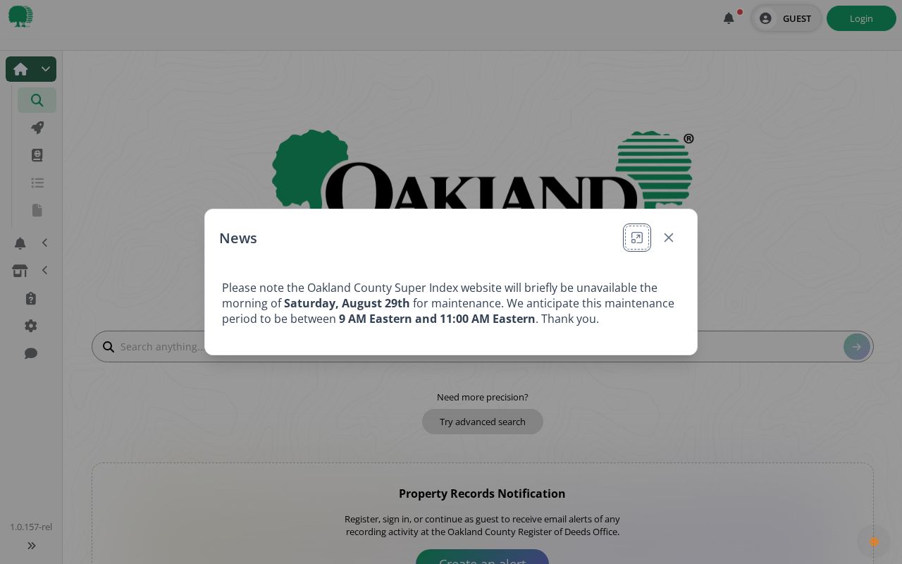
Free indexing is a lead, while printing or downloading a document costs money. A current title conclusion needs the recorded instrument and legal description, with confirmation from the custodian or a qualified title professional when legal reliance matters. Property Records Notification is a separate free alert tool; its ten-digit PIN option is the most precise key for monitoring one’s own filing activity.
- Parcel
- A defined piece of land identified in Oakland County systems by a PIN.
- Situs address
- The physical location of the parcel, which can differ from where tax notices are sent.
- Plat
- A recorded subdivision map that can connect a lot and block to roads and an address.
- Criss-cross directory
- A reverse directory arranged by street and house number, used to find a dated listing from an address.
Oakland Street Records by Address
No one roll answers every Oakland by-address question. The county’s map, land index, voter-file request route, and local permit files each provide a distinct kind of evidence. The coverage below makes the handoff clear, including the alternatives when a web result is incomplete. In particular, building and code records remain with the particular city, village, or township, and no countywide building-permit index was confirmed.
| Address-keyed source | Record keeper | Street evidence | Access route |
|---|---|---|---|
| Property Gateway | County with local assessment contributors | PIN, map location, local parcel products, and possible owner or mailing fields | Address, PIN, or map search; some reports are paid. |
| Enterprise GIS | Oakland County GIS | Parcel geometry and district, precinct, ZIP, and municipal context | Interactive map or official query service. |
| Super Index | Clerk/Register of Deeds | Recorded parties, instruments, PIN, and legal-description trail | Free index search from 1964 online; paid copies; older material through office or partners. |
| Qualified Voter File | Michigan Bureau of Elections or local clerk | Legally releasable registration fields and optional voter history | FOIA request scoped by county, jurisdiction, district, or precinct. |
| Permit or code file | Responsible city, village, or township | Public address, applicant, inspection, or case-date material where open | Local portal or narrow address-and-date request. |
| Historical directories | OCHS, libraries, and archives | Dated address and occupant listing for the relevant run | Catalog, research visit, microfilm, or library request. |
The transfer chain is address or PIN to parcel, parcel to recorded document, and document to legal description. If an address does not appear in an index, try the subdivision, lot and block, prior spelling, or legal description. Plat records can be searched in the county system by record type, county, and subdivision, followed by the record attachment or TIFF map.
Oakland Streets Need CVT Checks
Oakland County has 62 cities, villages, and townships, often called CVTs in county records. That geography matters because a parcel may be visible in county GIS while its building permit, cemetery record, local clerk file, or code record stays with the particular community. Before seeking an address-keyed local file, identify the CVT shown by the parcel and use the county local-communities directory to reach the responsible local government. A municipal website is not automatically the custodian of every court file, and court records do not move through the county FOIA route.
When an online municipal search does not exist, make the request narrow: give the address, parcel or permit number if known, record type, and a date range. Oakland County FOIA covers existing nonexempt county records and generally has five business days to respond, with a possible ten-business-day extension. The Oakland County FOIA Request Center is a county fallback, while local records should be directed to the correct CVT custodian.
Note: A ZIP Code Area and a municipal boundary can differ, so postal information should never replace the parcel’s CVT.
Oakland Street Voter Scope
Michigan.gov/Vote is an individualized service for a voter’s own status, clerk, ballot, and related election information. It is not a public street-browse tool. For a limited public record, use a local clerk or the Michigan Bureau of Elections Qualified Voter File request form. The documented geographic choices include an entire county, jurisdiction, district, village, county commissioner district, state legislative district, congressional district, school area, or a ward or precinct route. Request one geographic scope and respect the form’s delivery and certification requirements.
Michigan FOIA allows public voter records, but MCL 168.509gg withholds driver-license or state-ID numbers, month and day of birth, phone, email, signature, the last four digits of a Social Security number, certain registration details, and ACP records. A released record may include a name, residence or mailing address, year of birth, registration date, status, ID, or voter history when legally releasable. Voter history records participation, not ballot choices. The Michigan QVF request form gives the documented scope and delivery choices.
Oakland Street Criss-Cross Books
Historical reverse directories make Oakland address research useful when a modern parcel record is not the whole question. Bresser criss-cross volumes arrange streets alphabetically and addresses by house number, then show an occupant or business, phone, owner notation, first-listed year, new-arrival note, or relocation note where the edition provides it. The Oakland County Historical Society shelf list documents North Oakland County Criss-Cross editions for 1958 and 1960 and Bresser’s Cross-Index for South Oakland County for 1967–68. Geography and year control the result, so verify the volume before relying on a listing.
The OCHS searchable shelf list is the best first catalog check. For older or incomplete web coverage, OCHS has a research library in Pontiac and asks visitors to call before visiting. The Library of Michigan describes additional Polk and Bresser runs, including street, surname, phone, and classified formats. A historic listing can supply an address trail, but it is a dated publisher record rather than continuous proof of connection.
Oakland Street Directory Boundaries
Public address records leave important gaps. Parcel data can identify land and recorded parties. A property mailing address may point somewhere else. A directory is only a dated publisher listing, and a voter record covers registration subject to statutory redaction. Driver and vehicle data are protected under the Driver Privacy Protection Act, utility and delivery customer information are not public street-directory sources, and protected voter entries are withheld. Treat an absent result as “not located in that source,” not proof that a person has no Oakland connection.
Lawful personal use. Oakland address records may support personal research, civic context, and family-history work. Michigan stalking laws, including MCL 750.411h, prohibit repeated harassment, threats, or using public information to harm someone.
A suspicious deed or fee demand should be checked through the Register of Deeds, not through the sender. The county directs property-record concerns to the Property Records Notification and fraud-response service and the Clerk/Register of Deeds. Compare a claimed document number and fee with the county before sending money or identity documents.